<?xml version="1.0" encoding="UTF-8"?>
<gmd:MD_Metadata xmlns:gmd="http://www.isotc211.org/2005/gmd" xmlns:gco="http://www.isotc211.org/2005/gco" xmlns:srv="http://www.isotc211.org/2005/srv" xmlns:gmx="http://www.isotc211.org/2005/gmx" xmlns:gts="http://www.isotc211.org/2005/gts" xmlns:gsr="http://www.isotc211.org/2005/gsr" xmlns:gmi="http://www.isotc211.org/2005/gmi" xmlns:gml="http://www.opengis.net/gml/3.2" xmlns:xlink="http://www.w3.org/1999/xlink" xmlns:xsi="http://www.w3.org/2001/XMLSchema-instance" xsi:schemaLocation="http://www.isotc211.org/2005/gmd http://schemas.opengis.net/csw/2.0.2/profiles/apiso/1.0.0/apiso.xsd">
  <gmd:fileIdentifier>
    <gco:CharacterString>ff856656-138a-461e-bb0f-e20c9f799290</gco:CharacterString>
  </gmd:fileIdentifier>
  <gmd:language xmlns:gml="http://www.opengis.net/gml" xmlns:gfc="http://www.isotc211.org/2005/gfc">
    <gmd:LanguageCode codeList="http://www.loc.gov/standards/iso639-2/" codeListValue="fre" />
  </gmd:language>
  <gmd:characterSet xmlns:gml="http://www.opengis.net/gml" xmlns:gfc="http://www.isotc211.org/2005/gfc">
    <gmd:MD_CharacterSetCode codeListValue="utf8" codeList="http://standards.iso.org/iso/19139/resources/gmxCodelists.xml#MD_CharacterSetCode" />
  </gmd:characterSet>
  <gmd:hierarchyLevel xmlns:gml="http://www.opengis.net/gml" xmlns:gfc="http://www.isotc211.org/2005/gfc">
    <gmd:MD_ScopeCode codeList="http://standards.iso.org/iso/19139/resources/gmxCodelists.xml#MD_ScopeCode" codeListValue="nonGeographicDataset" />
  </gmd:hierarchyLevel>
  <gmd:hierarchyLevelName xmlns:gml="http://www.opengis.net/gml" xmlns:gfc="http://www.isotc211.org/2005/gfc">
    <gco:CharacterString>Série de données non géographiques</gco:CharacterString>
  </gmd:hierarchyLevelName>
  <gmd:contact xmlns:gml="http://www.opengis.net/gml" xmlns:gfc="http://www.isotc211.org/2005/gfc">
    <gmd:CI_ResponsibleParty>
      <gmd:organisationName>
        <gco:CharacterString>Institut National de l'Information Géographique et Forestière</gco:CharacterString>
      </gmd:organisationName>
      <gmd:contactInfo>
        <gmd:CI_Contact />
      </gmd:contactInfo>
      <gmd:role>
        <gmd:CI_RoleCode codeList="http://standards.iso.org/iso/19139/resources/gmxCodelists.xml#CI_RoleCode" codeListValue="pointOfContact" />
      </gmd:role>
    </gmd:CI_ResponsibleParty>
  </gmd:contact>
  <gmd:dateStamp xmlns:gml="http://www.opengis.net/gml" xmlns:gfc="http://www.isotc211.org/2005/gfc">
    <gco:DateTime>2023-12-05T12:04:26</gco:DateTime>
  </gmd:dateStamp>
  <gmd:metadataStandardName xmlns:gml="http://www.opengis.net/gml" xmlns:gfc="http://www.isotc211.org/2005/gfc">
    <gco:CharacterString>ISO 19115:2003/19139</gco:CharacterString>
  </gmd:metadataStandardName>
  <gmd:metadataStandardVersion xmlns:gml="http://www.opengis.net/gml" xmlns:gfc="http://www.isotc211.org/2005/gfc">
    <gco:CharacterString>1.0</gco:CharacterString>
  </gmd:metadataStandardVersion>
  <gmd:identificationInfo xmlns:gml="http://www.opengis.net/gml" xmlns:gfc="http://www.isotc211.org/2005/gfc">
    <gmd:MD_DataIdentification>
      <gmd:citation>
        <gmd:CI_Citation>
          <gmd:title>
            <gco:CharacterString>Plan IGN</gco:CharacterString>
          </gmd:title>
          <gmd:date>
            <gmd:CI_Date>
              <gmd:date>
                <gco:Date>2021-09-24T11:02:09.465000</gco:Date>
              </gmd:date>
              <gmd:dateType>
                <gmd:CI_DateTypeCode codeList="http://standards.iso.org/iso/19139/resources/gmxCodelists.xml#CI_DateTypeCode" codeListValue="revision" />
              </gmd:dateType>
            </gmd:CI_Date>
          </gmd:date>
          <gmd:date>
            <gmd:CI_Date>
              <gmd:date>
                <gco:Date>2021-09-20T15:28:44.797000</gco:Date>
              </gmd:date>
              <gmd:dateType>
                <gmd:CI_DateTypeCode codeList="http://standards.iso.org/iso/19139/resources/gmxCodelists.xml#CI_DateTypeCode" codeListValue="creation" />
              </gmd:dateType>
            </gmd:CI_Date>
          </gmd:date>
        </gmd:CI_Citation>
      </gmd:citation>
      <gmd:abstract>
        <gco:CharacterString>![entrez la description de l'image ici](https://geoservices.ign.fr/sites/default/files/styles/echelle_recadrage_00/public/2021-05/planign_Vignette.png?itok=vxTlNB6W "entrez le titre de l'image ici")
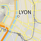
Plan IGN est un fonds cartographique IGN complet pensé entièrement pour un usage écran. Il est constitué de 19 niveaux de zoom qui cartographient avec précision et lisibilité la France de l’échelle monde au 1 : 1000 environ tout en proposant un contenu cartographique riche à grande échelle, notamment en zone urbaine.</gco:CharacterString>
      </gmd:abstract>
      <gmd:pointOfContact>
        <gmd:CI_ResponsibleParty>
          <gmd:organisationName>
            <gco:CharacterString>Institut National de l'Information Géographique et Forestière</gco:CharacterString>
          </gmd:organisationName>
          <gmd:contactInfo>
            <gmd:CI_Contact />
          </gmd:contactInfo>
          <gmd:role>
            <gmd:CI_RoleCode codeList="http://standards.iso.org/iso/19139/resources/gmxCodelists.xml#CI_RoleCode" codeListValue="publisher" />
          </gmd:role>
        </gmd:CI_ResponsibleParty>
      </gmd:pointOfContact>
      <gmd:descriptiveKeywords>
        <gmd:MD_Keywords>
          <gmd:keyword>
            <gco:CharacterString>carte</gco:CharacterString>
          </gmd:keyword>
          <gmd:keyword>
            <gco:CharacterString>cartes</gco:CharacterString>
          </gmd:keyword>
          <gmd:keyword>
            <gco:CharacterString>ign</gco:CharacterString>
          </gmd:keyword>
          <gmd:keyword>
            <gco:CharacterString>plan</gco:CharacterString>
          </gmd:keyword>
        </gmd:MD_Keywords>
      </gmd:descriptiveKeywords>
      <gmd:language>
        <gco:CharacterString>fre</gco:CharacterString>
      </gmd:language>
    </gmd:MD_DataIdentification>
  </gmd:identificationInfo>
  <gmd:distributionInfo xmlns:gml="http://www.opengis.net/gml" xmlns:gfc="http://www.isotc211.org/2005/gfc">
    <gmd:MD_Distribution>
      <gmd:transferOptions>
        <gmd:MD_DigitalTransferOptions>
          <gmd:onLine>
            <gmd:CI_OnlineResource>
              <gmd:linkage>
                <gmd:URL>https://geoservices.ign.fr/documentation/donnees/cartes/planign</gmd:URL>
              </gmd:linkage>
              <gmd:protocol>
                <gco:CharacterString>WWW:LINK-1.0-http--link</gco:CharacterString>
              </gmd:protocol>
              <gmd:name>
                <gco:CharacterString>Documentation  PLAN IGN</gco:CharacterString>
              </gmd:name>
              <gmd:description>
                <gco:CharacterString>La documentation est disponible sur le site Géoservices :https://geoservices.ign.fr/documentation/donnees/cartes/planign</gco:CharacterString>
              </gmd:description>
            </gmd:CI_OnlineResource>
          </gmd:onLine>
          <gmd:onLine>
            <gmd:CI_OnlineResource>
              <gmd:linkage>
                <gmd:URL>https://geoservices.ign.fr/planign</gmd:URL>
              </gmd:linkage>
              <gmd:protocol>
                <gco:CharacterString>WWW:LINK-1.0-http--link</gco:CharacterString>
              </gmd:protocol>
              <gmd:name>
                <gco:CharacterString>Fiche produit PLAN IGN</gco:CharacterString>
              </gmd:name>
              <gmd:description>
                <gco:CharacterString>La fiche produit est disponible sur le site Géoservices :https://geoservices.ign.fr/planign</gco:CharacterString>
              </gmd:description>
            </gmd:CI_OnlineResource>
          </gmd:onLine>
          <gmd:onLine>
            <gmd:CI_OnlineResource>
              <gmd:linkage>
                <gmd:URL>https://geoservices.ign.fr/planign#telechargement</gmd:URL>
              </gmd:linkage>
              <gmd:protocol>
                <gco:CharacterString>WWW:LINK-1.0-http--link</gco:CharacterString>
              </gmd:protocol>
              <gmd:name>
                <gco:CharacterString>Télécharger PLAN IGN</gco:CharacterString>
              </gmd:name>
              <gmd:description>
                <gco:CharacterString>None</gco:CharacterString>
              </gmd:description>
            </gmd:CI_OnlineResource>
          </gmd:onLine>
        </gmd:MD_DigitalTransferOptions>
      </gmd:transferOptions>
    </gmd:MD_Distribution>
  </gmd:distributionInfo>
</gmd:MD_Metadata>

