<?xml version="1.0" encoding="UTF-8"?>
<gmd:MD_Metadata xmlns:gmd="http://www.isotc211.org/2005/gmd" xmlns:gco="http://www.isotc211.org/2005/gco" xmlns:srv="http://www.isotc211.org/2005/srv" xmlns:gmx="http://www.isotc211.org/2005/gmx" xmlns:gts="http://www.isotc211.org/2005/gts" xmlns:gsr="http://www.isotc211.org/2005/gsr" xmlns:gmi="http://www.isotc211.org/2005/gmi" xmlns:gml="http://www.opengis.net/gml/3.2" xmlns:xlink="http://www.w3.org/1999/xlink" xmlns:xsi="http://www.w3.org/2001/XMLSchema-instance" xsi:schemaLocation="http://www.isotc211.org/2005/gmd http://schemas.opengis.net/csw/2.0.2/profiles/apiso/1.0.0/apiso.xsd">
  <gmd:fileIdentifier>
    <gco:CharacterString>6a0d51e3-a81b-4f96-826f-d25421c6492d</gco:CharacterString>
  </gmd:fileIdentifier>
  <gmd:language xmlns:gml="http://www.opengis.net/gml" xmlns:gfc="http://www.isotc211.org/2005/gfc">
    <gmd:LanguageCode codeList="http://www.loc.gov/standards/iso639-2/" codeListValue="fre" />
  </gmd:language>
  <gmd:characterSet xmlns:gml="http://www.opengis.net/gml" xmlns:gfc="http://www.isotc211.org/2005/gfc">
    <gmd:MD_CharacterSetCode codeListValue="utf8" codeList="http://standards.iso.org/iso/19139/resources/gmxCodelists.xml#MD_CharacterSetCode" />
  </gmd:characterSet>
  <gmd:hierarchyLevel xmlns:gml="http://www.opengis.net/gml" xmlns:gfc="http://www.isotc211.org/2005/gfc">
    <gmd:MD_ScopeCode codeList="http://standards.iso.org/iso/19139/resources/gmxCodelists.xml#MD_ScopeCode" codeListValue="nonGeographicDataset" />
  </gmd:hierarchyLevel>
  <gmd:hierarchyLevelName xmlns:gml="http://www.opengis.net/gml" xmlns:gfc="http://www.isotc211.org/2005/gfc">
    <gco:CharacterString>Série de données non géographiques</gco:CharacterString>
  </gmd:hierarchyLevelName>
  <gmd:contact xmlns:gml="http://www.opengis.net/gml" xmlns:gfc="http://www.isotc211.org/2005/gfc">
    <gmd:CI_ResponsibleParty>
      <gmd:organisationName>
        <gco:CharacterString>Institut National de l'Information Géographique et Forestière</gco:CharacterString>
      </gmd:organisationName>
      <gmd:contactInfo>
        <gmd:CI_Contact />
      </gmd:contactInfo>
      <gmd:role>
        <gmd:CI_RoleCode codeList="http://standards.iso.org/iso/19139/resources/gmxCodelists.xml#CI_RoleCode" codeListValue="pointOfContact" />
      </gmd:role>
    </gmd:CI_ResponsibleParty>
  </gmd:contact>
  <gmd:dateStamp xmlns:gml="http://www.opengis.net/gml" xmlns:gfc="http://www.isotc211.org/2005/gfc">
    <gco:DateTime>2023-12-05T12:04:20</gco:DateTime>
  </gmd:dateStamp>
  <gmd:metadataStandardName xmlns:gml="http://www.opengis.net/gml" xmlns:gfc="http://www.isotc211.org/2005/gfc">
    <gco:CharacterString>ISO 19115:2003/19139</gco:CharacterString>
  </gmd:metadataStandardName>
  <gmd:metadataStandardVersion xmlns:gml="http://www.opengis.net/gml" xmlns:gfc="http://www.isotc211.org/2005/gfc">
    <gco:CharacterString>1.0</gco:CharacterString>
  </gmd:metadataStandardVersion>
  <gmd:identificationInfo xmlns:gml="http://www.opengis.net/gml" xmlns:gfc="http://www.isotc211.org/2005/gfc">
    <gmd:MD_DataIdentification>
      <gmd:citation>
        <gmd:CI_Citation>
          <gmd:title>
            <gco:CharacterString>PCRS</gco:CharacterString>
          </gmd:title>
          <gmd:date>
            <gmd:CI_Date>
              <gmd:date>
                <gco:Date>2021-11-04T16:15:18.125000</gco:Date>
              </gmd:date>
              <gmd:dateType>
                <gmd:CI_DateTypeCode codeList="http://standards.iso.org/iso/19139/resources/gmxCodelists.xml#CI_DateTypeCode" codeListValue="revision" />
              </gmd:dateType>
            </gmd:CI_Date>
          </gmd:date>
          <gmd:date>
            <gmd:CI_Date>
              <gmd:date>
                <gco:Date>2021-09-20T16:42:30.631000</gco:Date>
              </gmd:date>
              <gmd:dateType>
                <gmd:CI_DateTypeCode codeList="http://standards.iso.org/iso/19139/resources/gmxCodelists.xml#CI_DateTypeCode" codeListValue="creation" />
              </gmd:dateType>
            </gmd:CI_Date>
          </gmd:date>
        </gmd:CI_Citation>
      </gmd:citation>
      <gmd:abstract>
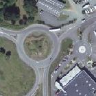
        <gco:CharacterString>![entrez la description de l'image ici](https://geoservices.ign.fr/sites/default/files/styles/echelle_recadrage_00/public/2021-07/pcrs_Vignette.jpg?itok=2-X-TZpq "entrez le titre de l'image ici")Le **Plan Corps de Rue Simplifié** est un produit topographique à très haute précisionProduit en partenariat avec les autorités publiques locales compétentes, le PCRS constitue le socle mutualisé servant de support aux applications requérant une précision de levé à très grande échelle, en particulier comme composante topographique de la réforme dite « anti-endommagement des travaux » ou « DT-DICT ».Le PCRS est en cours de constitution au niveau national avec une précision planimétrique de 10 cm (lien vers la carte d'avancement).Le produit PCRS est disponible en flux là où les accords de diffusion en open data le permettent.</gco:CharacterString>
      </gmd:abstract>
      <gmd:pointOfContact>
        <gmd:CI_ResponsibleParty>
          <gmd:organisationName>
            <gco:CharacterString>Institut National de l'Information Géographique et Forestière</gco:CharacterString>
          </gmd:organisationName>
          <gmd:contactInfo>
            <gmd:CI_Contact />
          </gmd:contactInfo>
          <gmd:role>
            <gmd:CI_RoleCode codeList="http://standards.iso.org/iso/19139/resources/gmxCodelists.xml#CI_RoleCode" codeListValue="publisher" />
          </gmd:role>
        </gmd:CI_ResponsibleParty>
      </gmd:pointOfContact>
      <gmd:language>
        <gco:CharacterString>fre</gco:CharacterString>
      </gmd:language>
    </gmd:MD_DataIdentification>
  </gmd:identificationInfo>
  <gmd:distributionInfo xmlns:gml="http://www.opengis.net/gml" xmlns:gfc="http://www.isotc211.org/2005/gfc">
    <gmd:MD_Distribution>
      <gmd:transferOptions>
        <gmd:MD_DigitalTransferOptions>
          <gmd:onLine>
            <gmd:CI_OnlineResource>
              <gmd:linkage>
                <gmd:URL>https://geoservices.ign.fr/services-web-experts-ortho</gmd:URL>
              </gmd:linkage>
              <gmd:protocol>
                <gco:CharacterString>WWW:LINK-1.0-http--link</gco:CharacterString>
              </gmd:protocol>
              <gmd:name>
                <gco:CharacterString>Accéder aux services web experts - PCRS</gco:CharacterString>
              </gmd:name>
              <gmd:description>
                <gco:CharacterString>Accéder au flux PCRS en utilisant la clé partagée "ortho" :https://geoservices.ign.fr/services-web-experts-ortho</gco:CharacterString>
              </gmd:description>
            </gmd:CI_OnlineResource>
          </gmd:onLine>
          <gmd:onLine>
            <gmd:CI_OnlineResource>
              <gmd:linkage>
                <gmd:URL>https://geoservices.ign.fr/pcrs</gmd:URL>
              </gmd:linkage>
              <gmd:protocol>
                <gco:CharacterString>WWW:LINK-1.0-http--link</gco:CharacterString>
              </gmd:protocol>
              <gmd:name>
                <gco:CharacterString>PCRS</gco:CharacterString>
              </gmd:name>
              <gmd:description>
                <gco:CharacterString>None</gco:CharacterString>
              </gmd:description>
            </gmd:CI_OnlineResource>
          </gmd:onLine>
        </gmd:MD_DigitalTransferOptions>
      </gmd:transferOptions>
    </gmd:MD_Distribution>
  </gmd:distributionInfo>
</gmd:MD_Metadata>