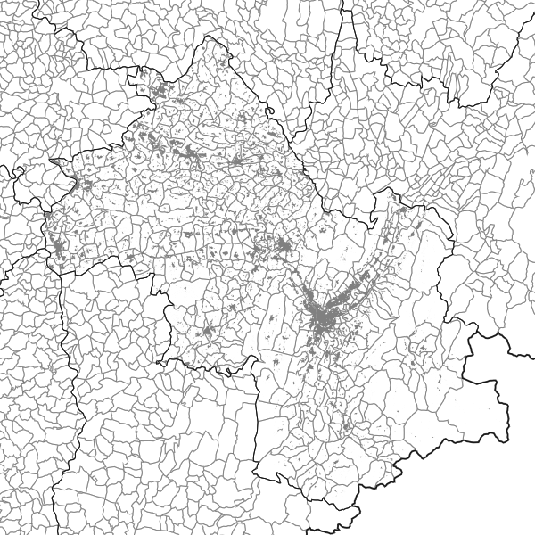
Tache urbaine de 2024- Isère
Enveloppes des bâtiments agrégés issues du cadastre DGFiP et de la BD TOPO (lorsqu’il y a absence de bâtiments dans les données du cadastre PCi vecteur) distants de 100m les uns des autres
Simple
- Date (Revision)
- 2025-06-13T11:50:32
- Date (Creation)
- 2024-04-08
- Citation identifier
- https://catalogue.open-datara.fr/geonetwork/srv/1c190c26-0464-478f-a124-1015edcca9f0
- Status
- Under development
- Point of contact
-
Organisation name Individual name Electronic mail address Role DDT 38 (Direction Départementale des Territoires de l'Isère)
Bureau SIG central et OBServatoires
Originator
- Maintenance and update frequency
- As needed
- Place
-
-
Auvergne-Rhône-Alpes
-
-
NouvellesRegionAdminExpress
-
-
AUVERGNE-RHONE-ALPES
-
-
Departement Auvergne-Rhone-Alpes
-
-
ISERE
-
-
GEMET - INSPIRE themes, version 1.0
-
-
Occupation des terres
-
- Theme
-
-
Votre thème
-
Votre entité
-
-
OPENDATA
-
-
données ouvertes
-
-
Domaines
-
-
Spécification locale
-
Occupation du sol
-
Grand public
-
DDT Isère
-
- Access constraints
- Intellectual property rights
- Other constraints
-
Pas de restriction d’accès public selon INSPIRE
- Use limitation
-
Licence Ouverte / Open Licence Version 2.0 https://www.etalab.gouv.fr/wp-content/uploads/2017/04/ETALAB-Licence-Ouverte-v2.0.pdf
- Spatial representation type
- Vector
- Denominator
- 5000
- Language
-
fre
- Character set
- UTF8
- Description
-
AUVERGNE-RHONE-ALPES
))
- Begin date
- 2024-04-08
- Reference system identifier
- EPSG / RGF93 / Lambert-93 (EPSG:2154) / 7.4
- Distribution format
-
Name Version ZIP
- OnLine resource
- Hierarchy level
- Dataset
Conformance result
- Date (Publication)
- Explanation
-
-- Information sur l'évaluation de la conformité (non INSPIRE) --
- Pass
- Yes
- Statement
-
Buffer de +50m puis de -40m autour des données de la table de bâti du cadastre et de la BD TOPO de l’année
l_tache_urbaine_2024_038
Metadata
- File identifier
- 1c190c26-0464-478f-a124-1015edcca9f0 XML
- Metadata language
-
fre
- Character set
- UTF8
- Hierarchy level
- Dataset
- Date stamp
- 2025-06-13T09:53:33.776789Z
- Metadata standard name
-
ISO 19115:2003/19139
- Metadata standard version
-
1.0
- Metadata author
-
Organisation name Individual name Electronic mail address Role DDT 38 (Direction Départementale des Territoires de l'Isère)
Bureau SIG central et OBServatoire
Resource provider
Overviews
Spatial extent
Provided by
